-
MECHANICAL ENGINEERING SERVICES
- MECHANICAL ENGINEERING SERVICES
- Modular Plant Design Services
- Proposal Review and Bid Management Services
- Virtual Prototyping Services
- Detailed Engineering Design Services
- Plant Design Engineering Services
- Thermal Modeling Services
- Tolerance Stackup Analysis
- Mechanical Engineering Analysis Services
- Visual Merchandising & Display
- CNC Services
- 3D Product Rendering and Modeling Services
- 3D Rendering, Modeling, & Drafting Services
- 3D Part Modeling Services
- Assembly Modeling Services
- 3ds Max Modeling Services
- 3D Product Animation Services
- 2D Drafting Services
-
View All
- Raster to Vector Conversions
- MicroStation Conversion Services
- PDF to DWG Conversion
- DWG to DGN Conversion
- MCD to DWG Conversion
- PLM Implementation & Customization
- Scanning and Measurement Services
- Prototyping and Rapid Prototyping Services
- Finite Element Analysis - FEA Services
- Product Design and Development
- Value Engineering Services
- Plant Design Management System
- Piping Design and Drafting Services
- Sheet Metal Design Services
- Casting Design and Manufacturing
- Reverse Engineering Services
- Process Planning and Automation
- Structural and Stress Analysis
- Outsourcing CAE - Modal Analysis
- Jigs and Fixture Design Services
- Tooling & Fixture Design and Drafting Services
- Tower Design
- Project Management Tools and Services
- Manufacturing Support and Process Planning
- Design for Manufacturing (DFM) Services
- Product Engineering and Development
- Plumbing and Firefighting Services
- Engineering Fabrication and Production Cost Estimation
- Industrial Automation Services
- Failure Analysis Services
- Computational Fluid Dynamics Services
- Crash Analysis Services
- Technical Publication Services
- Product Lifecycle Support
- Fatigue Analysis Services
- CATIA Services
- Autodesk Inventor Services
- Mechanical Concept Design Services
- Revit Family Creation Services
- 3D Laser Scanning Services
- SolidWorks Design Services
- Assembly Drawings Services
- Engineering Change Order Services
- Machine Design and Development Services
- HVAC System Replacement Services
- Fire Protection Engineering Services
- Office Furniture Design Services
- Parametric 3D Modeling Services
- Simulation Engineering Services
- Radon Testing Services
- 3D Modeling, Drafting, and Rendering Services for OEM
- 3D Rendering, Modeling, and Drafting Services for Visual Merchandisers
- Ship Deck Design and Drafting Services
-
ARCHITECTURAL SERVICES
- ARCHITECTURAL SERVICES
- Augmented Reality Interior Design Services
- MicroStation Drafting and Modeling Services
- Vacuum Casting Services
- Architectural Schematic Design Services
- Piping Spool Drawing Services
- Retail Visual Merchandising
- 3D Architectural Walkthroughs
- Technical Drawing Services
- Virtual Staging Services
- Landscape Design & Drafting Services
- Retail Space Design Service
- 3D Furniture Modeling
- 3D Rendering Services
- 3D Floor Plan Creation Services
- 3D Printing File Creation
- SketchUp Modeling Services
- Point Cloud Services
- Parametric and Computational Modeling Services
- Cabinet Drawing Services using Cabinet Vision Software
- Kitchen Cabinet Design Services
- Revit Modeling Services
-
View All
- Architectural Drafting & Detailing (CAD)
- Millwork Drawings
- 4D Construction Simulation Services
- 2D Floor Plan Creation Services
- Presentation Drawings Services
- 3D Architectural Visualization Services
- Augmented Reality Engineering Services
- 360 Degree Panorama Rendering Services
- 3D Virtual Tours and Walkthroughs
- Mixed Reality Engineering Services
- Virtual Reality Engineering Services
- Construction Solid Geometry Modeling Services
- Presentation Modeling Services
- Boundary Representation Modeling Services
- Real Estate Rendering Services
- Isometric Drawing Services
- Architectural Model Making Services
- Facade Engineering Services
- Telecom Network Drawings Services
- Interior Rendering Services
- Photorealistic Rendering Services
- BIM Level of Development Services
- Skylight Detailing Services
- Construction Administration Services
- Leed Consulting Services
- As-Built Drawings Services
- Construction Detail Drawings Services
- Component Drawing Services
-
CIVIL ENGINEERING SERVICES
- CIVIL ENGINEERING SERVICES
- Drone Mapping Services
- Contour Mapping Services
- Residential Drainage Design Services
- Construction Drawing Services
- HVAC Services
- MEP Design & Drafting Services
- Remote Drafting Services
- Land Surveying Services
- Outsource Geospatial Services
- Planimetric Mapping Services
- Topographic Mapping Services
- Photogrammetric Services
- Digital Elevation Modeling
- Terrain Modeling
- LiDAR Mapping Services
- GIS Surveying Services
- Cadastral Mapping Services
- Drainage Design Services
- 3D Coordination Services
- Civil Information Modeling Services
- Virtual Construction Services
- Construction Scheduling and Tracking Services
- 5D Simulation Services
- 4D Simulation Services
- Contractor Support Services
- Construction Quality Assurance Services
- Traffic Engineering Services
- Geothermal Engineering services
- Digital Twin Implementation Services
- Plumbing Design Services
- Construction Quantity Takeoff Services
- Stormwater Management Services
- Indoor Mapping Services
- Remote Sensing Services
- Drone Survey Services
- Resilience Engineering Services
- Aerial Mapping Services
- Civil 3D Modeling, Drafting & Rendering Services
-
STRUCTURAL ENGINEERING DESIGN SERVICES
- STRUCTURAL ENGINEERING DESIGN SERVICES
- Precast Panel Detailing Services
- Skid Design Services
- High Rise Structures Design & Analysis
- Industrial Structures Design & Analysis
- Custom Homes Design & Analysis
- Retrofitting & Rehabilitation of Structures
- Finite Element Modeling and Analysis
- Peer Review Services
- Structural Design and Drafting Services
- Structural Fabrication Drawing Services
- Structural Steel Detailing Services
- Structural Shop Drawing Services
- Structural 3D Modeling, Drafting, and Rendering Services
- Rebar Detailing Services
- CAD SERVICES
-
BIM
- BIM
- Mechanical BIM Services
- BIM 5D Cost Estimation Services
- BIM Component Creation Services
- Laser Scan to BIM Services
- As-built BIM Modeling Services
- BIM App Development Services
- BIM Model Auditing Services
- BIM Execution Planning Services
- BIM Clash Detection Services
- BIM 6D Modeling Services
- BIM Coordination Services
- BIM Quantity Estimation Services
- BIM and 3D Virtual Reality Services
- BIM for Facility Management Services
- Structural BIM Consulting and Design Services
- BIM for Civil and Infrastructure Projects
- Civil BIM Services
- Architectural BIM Services
- Electrical BIM Services
- Structural BIM Drafting Services
- BIM Energy Modeling Services
- BIM Lean Construction Services
- 4D BIM Modeling Services
-
ELECTRICAL ENGINEERING SERVICES
- ELECTRICAL ENGINEERING SERVICES
- Lighting Control and Design Services
- Control System Engineering Services
- VLSI Design Services
- Hardware Design Services
- Electrical Instrumentation Services
- Electrical Design and Layout Services
- PCB Design and Layout Services
- Electrical Systems Design
- Solar Panel Design Services
- FPGA Design Services
- Embedded System Design Services
- Electrical Schematic Drawing Services
- Electronic Circuit Design Services
- Energy Modeling Services
- Electrical Grounding System Design Services
- Electrical Drafting Services
- PCB Reverse Engineering Services
- Electrical 2D Drafting Services
- Electrical Calibration Services
-
INFRASTRUCTURE ENGINEERING SERVICES
- INFRASTRUCTURE ENGINEERING SERVICES
- Construction Documentation Services
- Construction Support Services
- Thematic Mapping Services
- Parcel Mapping Services
- Land Development Design Services
- Town Planning Services
- Urban Development Services
- Storm and Sewer Drainage Design Services
- Geographic Information System Services
- GIS and CADD Data Development and Maintenance
- Underground Utility Mapping Services
- Highway Engineering Services
- Public Health Engineering Services
- 3D Corridor Mapping and Generation of GIS Database Services
- Construction Sequencing Services
- Infrastructure Planning Services
- Geotechnical Engineering Services
- Construction Phase Services
- Energy Auditing Services
- Public Health Engineering Design Services
- INDUSTRIES
- Engineering - UK
- ARTICLES
- CASE STUDIES
- Mechanical Engineering
Mechanical Engineering Services: We offer specialized engineering services. Get more information on our mechanical engineering services.
- Modular Plant Design Services
- Proposal Review and Bid Management Services
- Virtual Prototyping Services
- Detailed Engineering Design Services
- Plant Design Engineering Services
- Thermal Modeling Services
- Tolerance Stackup Analysis
- Mechanical Engineering Analysis Services
- Visual Merchandising & Display
- CNC Services
- 3D Product Rendering and Modeling Services
- 3D Rendering, Modeling, & Drafting Services
- 3D Part Modeling Services
- Assembly Modeling Services
- 3ds Max Modeling Services
- 3D Product Animation Services
- 2D Drafting Services
- Raster to Vector Conversions
- MicroStation Conversion Services
- PDF to DWG Conversion
- DWG to DGN Conversion
- MCD to DWG Conversion
- Scanning and Measurement Services
- PLM Implementation & Customization
- Prototyping and Rapid Prototyping Services
- Finite Element Analysis - FEA Services
- Product Design and Development
- Value Engineering Services
- Plant Design Management System
- Piping Design and Drafting Services
- Sheet Metal Design Services
- Casting Design and Manufacturing
- Reverse Engineering Services
- Process Planning and Automation
- Structural and Stress Analysis
- Outsourcing CAE - Modal Analysis
- Jigs and Fixture Design Services
- Tooling & Fixture Design and Drafting Services
- Tower Design
- Project Management Tools and Services
- Manufacturing Support and Process Planning
- Design for Manufacturing (DFM) Services
- Product Engineering and Development
- Plumbing and Firefighting Services
- Engineering Fabrication and Production Cost Estimation
- Industrial Automation Services
- Failure Analysis Services
- Computational Fluid Dynamics Services
- Crash Analysis Services
- Technical Publication Services
- Product Lifecycle Support
- Fatigue Analysis Services
- CATIA Services
- Autodesk Inventor Services
- Mechanical Concept Design Services
- Revit Family Creation Services
- 3D Laser Scanning Services
- SolidWorks Design Services
- Assembly Drawings Services
- Engineering Change Order Services
- Machine Design and Development Services
- HVAC System Replacement Services
- Fire Protection Engineering Services
- Office Furniture Design Services
- Parametric 3D Modeling Services
- Simulation Engineering Services
- Radon Testing Services
- 3D Modeling, Drafting, and Rendering Services for OEM
- 3D Rendering, Modeling, and Drafting Services for Visual Merchandisers
- Ship Deck Design and Drafting Services
- Architectural Services
Architectural Services: We offer specialized engineering services. Get more information on our architectural services and sub-services.
- Augmented Reality Interior Design Services
- MicroStation Drafting and Modeling Services
- Vacuum Casting Services
- Architectural Schematic Design Services
- Piping Spool Drawing Services
- Retail Visual Merchandising
- 3D Architectural Walkthroughs
- Technical Drawing Services
- Virtual Staging Services
- Landscape Design & Drafting Services
- Retail Space Design Service
- 3D Furniture Modeling
- 3D Rendering Services
- 3D Floor Plan Creation Services
- 3D Printing File Creation
- Architectural Drafting & Detailing (CAD)
- Millwork Drawings
- SketchUp Modeling Services
- Point Cloud Services
- Parametric and Computational Modeling Services
- Cabinet Drawing Services using Cabinet Vision Software
- Kitchen Cabinet Design Services
- Revit Modeling Services
- 4D Construction Simulation Services
- 2D Floor Plan Creation Services
- Presentation Drawings Services
- 3D Architectural Visualization Services
- Augmented Reality Engineering Services
- 360 Degree Panorama Rendering Services
- 3D Virtual Tours and Walkthroughs
- Mixed Reality Engineering Services
- Virtual Reality Engineering Services
- Construction Solid Geometry Modeling Services
- Presentation Modeling Services
- Boundary Representation Modeling Services
- Real Estate Rendering Services
- Isometric Drawing Services
- Architectural Model Making Services
- Facade Engineering Services
- Telecom Network Drawings Services
- Interior Rendering Services
- Photorealistic Rendering Services
- BIM Level of Development Services
- Skylight Detailing Services
- Construction Administration Services
- Leed Consulting Services
- As-Built Drawings Services
- Construction Detail Drawings Services
- Component Drawing Services
- Civil Engineering
Civil Engineering Services: We offer specialized engineering services. Get more information on our civil engineering services and sub-services.
- Drone Mapping Services
- Contour Mapping Services
- Residential Drainage Design Services
- Construction Drawing Services
- HVAC Services
- MEP Design & Drafting Services
- Remote Drafting Services
- Land Surveying Services
- Geospatial Services
- Planimetric Mapping Services
- Orthophoto Production Services
- Topographic Mapping Services
- Photogrammetric Services
- Digital Elevation Modeling
- Terrain Modeling Services
- LiDAR Mapping Services
- GIS Surveying Services
- Cadastral Mapping Services
- Drainage Design Services
- 3D Coordination Services
- Civil Information Modeling Services
- Virtual Construction Services
- Construction Scheduling and Tracking Services
- 5D Simulation Services
- 4D Simulation Services
- Contractor Support Services
- Construction Quality Assurance Services
- Traffic Engineering Services
- Geothermal Engineering services
- Digital Twin Implementation Services
- Plumbing Design Services
- Construction Quantity Takeoff Services
- Stormwater Management Services
- Indoor Mapping Services
- Remote Sensing Services
- Drone Survey Services
- Resilience Engineering Services
- Aerial Mapping Services
- Civil 3D Modeling, Drafting & Rendering Services
- Structural Engineering Design
Structural Engineering Design Services: We offer specialized engineering services. Get more information on our structural engineering design services.
- Precast Panel Detailing Services
- Skid Design Services
- High Rise Structures Design & Analysis
- Industrial Structures Design & Analysis
- Custom Homes Design & Analysis
- Retrofitting & Rehabilitation of Structures
- Finite Element Modeling and Analysis
- Peer Review Services
- Structural Design and Drafting Services
- Structural Fabrication Drawing Services
- Structural Steel Detailing Services
- Structural Shop Drawing Services
- Structural 3D Modeling, Drafting, and Rendering Services
- Rebar Detailing Services
- CAD Services
CAD Services: We offer specialized engineering services. Get more information on our CAD services.
- BIM
BIM Services : We offer specialized engineering services. Get more information on our BIM services and sub-services.
- Mechanical BIM Services
- BIM 5D Cost Estimation Services
- BIM Component Creation Services
- Laser Scan to BIM Services
- As-built BIM Modeling Services
- BIM App Development Services
- BIM Model Auditing Services
- BIM Execution Planning Services
- BIM Clash Detection Services
- BIM 6D Modeling Services
- BIM Coordination Services
- BIM Quantity Estimation Services
- BIM and 3D Virtual Reality Services
- BIM for Facility Management Services
- Structural BIM Consulting and Design Services
- BIM for Civil and Infrastructure Projects
- Civil BIM Services
- Architectural BIM Services
- Electrical BIM Services
- Structural BIM Drafting Services
- BIM Energy Modeling Services
- BIM Lean Construction Services
- 4D BIM Modeling Services
- Electrical Engineering
Electrical Engineering Services: We offer specialized engineering services. Get more information on our electrical engineering services and sub-services.- Lighting Control and Design Services
- Control System Engineering Services
- VLSI Design Services
- Hardware Design Services
- Electrical Instrumentation Services
- Electrical Systems Design
- Electrical Design and Layout Services
- PCB Design and Layout Services
- Solar Panel Design Services
- FPGA Design Services
- Embedded System Design Services
- Electrical Schematic Drawing Services
- Electronic Circuit Design Services
- Energy Modeling Services
- Electrical Grounding System Design Services
- Electrical Drafting Services
- PCB Reverse Engineering Services
- Electrical 2D Drafting Services
- Electrical Calibration Services
- Infrastructure Engineering
Infrastructure Engineering Services : We offer specialized engineering services. Get more information on our infrastructure engineering design services and sub-services.- Construction Documentation Services
- Construction Support Services
- Thematic Mapping Services
- Parcel Mapping Services
- Land Development Design Services
- Town Planning Services
- Urban Development Services
- Storm and Sewer Drainage Design Services
- Geographic Information System Services
- GIS and CADD Data Development and Maintenance
- Underground Utility Mapping Services
- Highway Engineering Services
- Public Health Engineering Services
- 3D Corridor Mapping and Generation of GIS Database Services
- Construction Sequencing Services
- Infrastructure Planning Services
- Geotechnical Engineering Services
- Construction Phase Services
- Energy Auditing Services
- Public Health Engineering Design Services
- Industries
Industries- Engineering - UK
Engineering - UK : We offer specialized engineering services. Get more information on our Engineering - UK services and sub-services.- Articles
Engineering Service Articles: Our engineering resources are comprehensive, informative, and well-researched. Check out our engineering service articles.- Civil Engineering Articles
- The Impact of Technological Advancements on Civil and Construction Industries
- How Can HVAC Systems Help Manage the Air Quality During this Covid Pandemic?
- Can MEP and HVAC Implementation Cut Down Airborne Transmitted Diseases?
- Top 8 Upcoming Development and Trends in Civil Engineering for 2018 and Beyond
- Top 6 Construction Cost Estimation Tips That Help You Save Money
- Construction Cost Estimation Services
- General Articles
- Importance of Accurate Structural Shop Drawings in Construction Projects
- Disrupting Design Norms - How CAD Drafting is Dethroning Manual Methods
- Shaping the Future: How Computer-Aided Design is Transforming Engineering
- Interpreting the Nuances of Design Improvement with Finite Element Analysis
- The Intricacies of 3D Architectural Visualization and its Influence on Real Estate
- Why You Should Seriously Consider Outsourced Engineering Services?
- How is Engineering Outsourcing Driving Innovation in Today's World
- Outsource Engineering Services: The Pros, Cons and Reasons Why You Should Consider It
- BIM Optimize Budget Utilization and Improve Infrastructure Projects
- Breaking Down the Enigma of Technical and Construction Documentation
- How to Choose the Best Architectural Engineering Service Provider
- Things to Keep in Mind While Outsourcing Mechanical Engineering Services
- Top Engineering Outsourcing Predictions for 2018
- Offshoring and the Future of US Engineering: An Overview
- Benefits of Outsourcing Engineering Services
- Outsourcing Engineering Services to India
- Outsource 3D Printing to Help Hospitals and Doctors Fight against COVID-19
- Case Studies
Engineering Service Case Studies: We provide reliable customized solutions to unique customer problems. Read our customer success stories.- Civil Engineering
- Outsource2india Provided Cabinet Designing Using Cabinet Vision Software
- Outsource2india Provided Point Cloud to 3D Modeling to a Scanning Partner
- Outsource2india Helped a Port Contractor to Visualize the Port Dredging Process
- O2I Provided HVAC Modeling of 19-Story Commercial Building for American General Contractor
- O2I Provided UAV LiDAR Mapping of Canadian Railroad of more than 600 Km
- O2I Provided Construction Drawings for a Top Manufacturing Firm
- O2I Provided MEP Services to an Award-winning Design Firm
- Outsource2india Provided Revit MEP Services to UK-based Engineering Consultants
- Outsource2india Provided MEP Design and Drafting Services to an Australian Electric Service Company
- Outsource2india Converted Scans to BIM Models for a European Client
- O2I Provided Construction Drawings for a Top Historic Property Management Firm
- Outsource2india Provided SketchUp Modeling Services to Norwegian Architectural Firm
- Outsource2india Provided Construction Drawings for Top Italian Architectural Firm
- O2I Provided Radius Mapping Services to US-based Land Expedition Services Firm
- O2I Provided Top-notch BIM solutions for Top Saudi MEP Services Leader
- CAD Conversion of Property Sketches for an Interior Designer
- 3D Rendering for Interior Design
- 3D Renderings, 2d construction sets and 3D BIM Modeling Services for a US Firm
- Precast Design Modification using REVIT
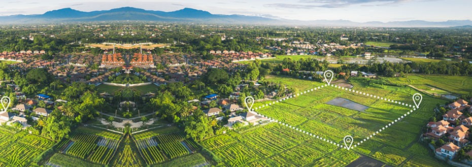
Outsource Land Surveying Services
We provide reliable land surveying services where our specialists survey everything from highways, to bridges and buildings with precision technology at rates starting at $12 per hour
Surveying is critical for construction projects to ensure the safety of personnel and construction itself. It's both a field and desk service where high order GPS and total stations are used in addition to terrestrial and aerial scanners. In simple terms, the cost of procuring the technology and establishing a team of full-time employees for land surveying can dent your operating finances. This is why it's essential to outsource land surveying services to the best land surveying services in India.
Outsource2india is a top land surveying service provider whose rich expertise in land survey and mapping has already benefitted architectural and civil firms globally. We have been helping engineers, architects, and builders from the past 27 years. When you outsource land surveying services, we accelerate the project's pace by using sophisticated software like AutoCAD to draft detailed plans that include site measurements.
Land Surveying Services We Offer
At O2I, we have 27 years of experience being a world-class land surveying service provider. Our clients approach us on the merits of our past and recent accomplishments. Most of whom always feel assured and satisfied with our land surveying services. Being a top land surveying services company, we offer the following land surveying solutions -
Land Surveying

At O2I, we always strive to meet your land surveying needs as per the SLA. Our land surveyors will measure elevation, gradient, curves, and much more to ensure the land is stable to sustain heavy constructions like highways, bridges, and utility corridors. Being a top land surveying services providing company, we capture the information through extensive mapping so that the construction will be safe irrespective of changing seasons.
Highway Surveying

We have aboard OSHA-certified surveying experts who are adept at collecting terrain data using mapping tools so the landscape and sustainability can be understood beforehand. This helps is designing safe highways that meet the motorable standards set by county and state. As part of the highway survey services, we analyze data for topography and right of way, DOT plans, Easement plans, so on.
Bridge Surveying

High-budget constructions like bridges require incredible precision to ensure it's traversable by motorists and pedestrians. We survey bridges using precision measuring equipment to ensure the construction which follows is on-budget, compliant with safety standards, and as per the blueprint. With a team of experienced surveyors, we perform easement research on boundaries and location, study topography, layout, and collect data for as-built models.
Utility Tunnel Surveying
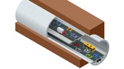
We provide comprehensive surveying services to city municipality and large utility projects where the pipes and channels run through vast landscapes. So irrespective of the terrain-type, we conduct surveys to ensure your project is compliant with the local laws and doesn't exceed the budget. We survey the boundary, location, topography, and much more to ensure the feasibility of utility corridors.
Topographic Surveying

From builder projects to municipality projects we undertake topographic survey needs for private and public authorities to ensure a sustainable layout is developed for civilian activities. We perform high-quality topography surveys to collect data for developing detailed models compliant with the safety standards.
ALTA Title Surveying
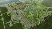
ALTA surveys are an advanced substitute for standard boundary surveys. Our licensed surveyors use the special processes and follow legal protocols to help you obtain a detailed map of land parcel with all the latest improvements in the insured title. This streamlines the CRE transactions without stretching your budget.
Boundary Surveying

Surveying boundaries is an old practice that frequently transforms every year as newer techniques replace the dated ones. We, at O2I, use modern principles and technology to provide a detailed map of boundaries and subdivisions by recording evidence through field and desk surveys. We collect the evidence and compile reports for boundary decisions and project plans.
Condominium Surveying
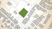
We help builders who want to survey apartments or empty land to construct condominiums. We survey the built-up area to determine the separation between individual units on common land. We perform complex site plan and floor plan surveys to help you determine the exact layouts.
Layout Surveying
If you need land surveying experts to complete the surveying on time and within the stipulated budget, you needn't look past us. Our accuracy and responsiveness can't be matched by any other land surveyors. Our team has OSHA certification to handle the complex requirements of the construction industry as well as state laws.
Land Surveying Process We Follow
Land Surveying Services from O2I is a cost-saving solution because you get to avoid spending hundreds of dollars on special surveying software and modeling tools. If you don't have surveyors on board, hiring costs can be extra. Outsourcing land surveying services guarantees transparency as it involves the following methods -
01. Requirement Discovery
We engage clients to discover their business requirements and challenges in the current workflow
02. Collection of Preliminary Data
We collect and analyze the preliminary data acquired through communication to understand the feasibility of the survey
03. Team Selection
We select OSHA certified surveyors with specialization in select fields and technology and sign the NDA before cutting out the project roles
04. Land Surveying
We will create a custom workflow for your project and stick to the work plan to ensure the survey yields accurate data
05. Quality Check
The data aggregated from the land surveying services are verified using modeling tools to ensure the outcome is 100% reliable
06. Report Submission
We summarize our findings in a detailed report and submit the same within the stipulated deadline
Other Services You Can Benefit From
Why Outsource Land Surveying Services to Outsource2india?
O2I is a go-to choice for architectural and engineering firms in search of the best land surveying service provider in India. By serving more than 2000 happy customers we continue our mission to handle outsourced land surveying services using world-class methods. O2I is a leading provider of land surveying services in India for the following reasons -
-
Friendly Rates
Our land surveying services can be ordered at affordable rates so customizing the order is easy as we assist our clients to pick select land surveying solutions instead of the whole solution package.
-
High-quality Land Surveying Services
We offer top-notch land surveying services to all our clients. We validate the quality of data before furnishing the same to our clients. We always ensure the data is unambiguous.
-
Project Management Software
We use land surveying software to automate portions of surveys data collection and management so it helps us accelerate the outcome of land surveying services.
-
100% Data Security
Outsource2india is an ISO/IEC 27001:2013 certified land surveying outsourcing company. We are proactive when it comes to data protection so we practice the best data management techniques to ensure compliance.
-
Quick Turnaround Time
We committedly deliver the land surveying services within the promised TAT. Our team swiftly commences the task on the client's approval leading to quick results.
-
ISO Certified Land Surveying Services Provider
O2I is an ISO 9001:2015 certified Land Surveying service company where project workflow meets the compliances and mandatory standards.
-
Scalable Services
If you want land surveying services that can be scaled amid an ongoing project, we'll move your request thorough channels and get it approved and implemented in no time.
-
Experienced Land Surveying Professionals
We have highly skilled and OSHA certified surveyors who operate from a secure ODC to deliver projects on time.
-
24/7 Support
You can get professional support anytime, anywhere from our contact center agents through a call, email, or webchat. We support all our clients in the language they prefer.
Client Success Stories

O2I Provided Construction Drawings for a Top Historic Property Management Firm
A top property management company in the US required our expertise to handle construction drawings. We provided the designs in no time and the client was glad about the outcome.
Read more
Outsource2india Provided Construction Drawings for Top Italian Architectural Firm
An architectural company from Italy was in search of a reliable construction drawing partner to design a London-based apartment complex. We provided resources to deliver quality results.
Read moreOutsource Land Surveying Services to Outsource2india
Testimonials
Outsource2india has been a tremendous resource for our engineering department. They are very precise and attentive to all our needs and have been able to learn our procedures quicker than I ever thought possible.
General Partner, a Manufacturing company in the US More Testimonials »With 27 years of rich experience in Land Surveying, O2I has garnered the reputation as a visionary enterprise offering a wide range of civil engineering services. Besides being a top provider of land surveying services, we have a global network of surveyors and remote service partners through whom we help our clients get their requirements met. We operate out of secure offshore delivery centers spanned across 4 continents. We routinely see a spike in demand for our services thanks to our team and their ability to keep up with the demand. We take great pride in our growth from a small firm to a large land surveying service providing serving clients from all geography.
Contact us to outsource Land Surveying services and get a free quote in 24 hours. We will walk you through the process and ensure timely services.

Get a FREE QUOTE!
Decide in 24 hours whether outsourcing will work for you.
Have specific requirements? Email us at:

Join the growth phase at Flatworld Solutions as a Partner
Service distributorship and Marketing partner roles are available in select countries. If you have a local sales team or are a person of influence in key areas of outsourcing, it’s time to engage fruitfully to ensure long term financial benefits. Currently business partnerships are open for Photo Editing, Graphic Design, Desktop Publishing, 2D and 3D Animation, Video Editing, CAD Engineering Design and Virtual Walkthroughs.
Reach out to us for a quick direct response from decision makers at the Flatworld Solutions global team.
Contact us for more information Key Differentiators
- Pricing
- FTE Pricing FAQs
- Infrastructure
- About us
- Customer Testimonials
- Workflow & Quality Assurance
- Project Management Software
- Project Management Process
- Global Delivery Centers
- Tools & Technologies
Mechanical - Industries
 Case Studies
- Outsource2india Provided Cabinet Designing Using Cabinet Vision Software
- Outsource2india Provided Point Cloud to 3D Modeling to a Scanning Partner
- Outsource2india Helped a Port Contractor to Visualize the Port Dredging Process
- O2I Provided HVAC Modeling of 19-Story Commercial Building for American General Contractor
- O2I Provided UAV LiDAR Mapping of Canadian Railroad of more than 600 Km
- O2I Provided Construction Drawings for a Top Manufacturing Firm
- O2I Provided MEP Services to an Award-winning Design Firm
- Outsource2india Provided Revit MEP Services to UK-based Engineering Consultants
- Outsource2india Provided MEP Design and Drafting Services to an Australian Electric Service Company
- Outsource2india Converted Scans to BIM Models for a European Client
- O2I Provided Construction Drawings for a Top Historic Property Management Firm
- Outsource2india Provided SketchUp Modeling Services to Norwegian Architectural Firm
- Outsource2india Provided Construction Drawings for Top Italian Architectural Firm
- O2I Provided Radius Mapping Services to US-based Land Expedition Services Firm
- O2I Provided Top-notch BIM solutions for Top Saudi MEP Services Leader
- CAD Conversion of Property Sketches for an Interior Designer
- 3D Rendering for Interior Design
- 3D Renderings, 2d construction sets and 3D BIM Modeling Services for a US Firm
- Precast Design Modification using REVIT
Civil Case Studies
Get a FREE QUOTE!
Decide in 24 hours whether outsourcing will work for you.
Have specific requirements? Email us at:

Land Surveying Services FAQs
-
What is land surveying?
Land surveying is the art, technique, and science of determining the 3D terrestrial positions of points on land surfaces and the distances and angles between them.
-
Why have land surveyed?
The main purpose of performing land surveying is to locate, describe, and map the boundaries and corners of a piece of land, including the topography of the land.
The information on this website is protected by copyright. Users of this website are not authorized to redistribute, reproduce, republish, modify, or make commercial use of the information without the written authorization of Flatworld Solutions Pvt. Ltd. We are committed to the prevention of copyright infringement. Read more about Flatworld's Terms of Use.Languages: English | Francais | Español | Deutsch | All Services | About Us | How We Work | ResourcesThis website is a property of Flatworld Solutions Inc New Jersey, USA. Privacy Policy | Terms of UseQuick Links

Third-party logos displayed on the website are not owned by us, and are displayed only for the representation purpose. The ownership and copyright of Logos belong to their respective organizations.


